
The Ring Barrier in Detail
How Local Input Helped Shape the Plan
The U.S. Army Corps of Engineers' Galveston Ring Barrier design was shaped by years of community engagement. Here is how feedback from Galveston's neighborhoods made the plan stronger.
A Plan Built With the Community
The Galveston Ring Barrier is not a fixed line drawn by engineers in a distant office. It is the product of several years of public meetings, neighborhood input, and iterative design — a process that changed the plan in meaningful ways.
The sections below trace how specific community concerns led to specific design changes, and how the proposed plan evolved as a result.
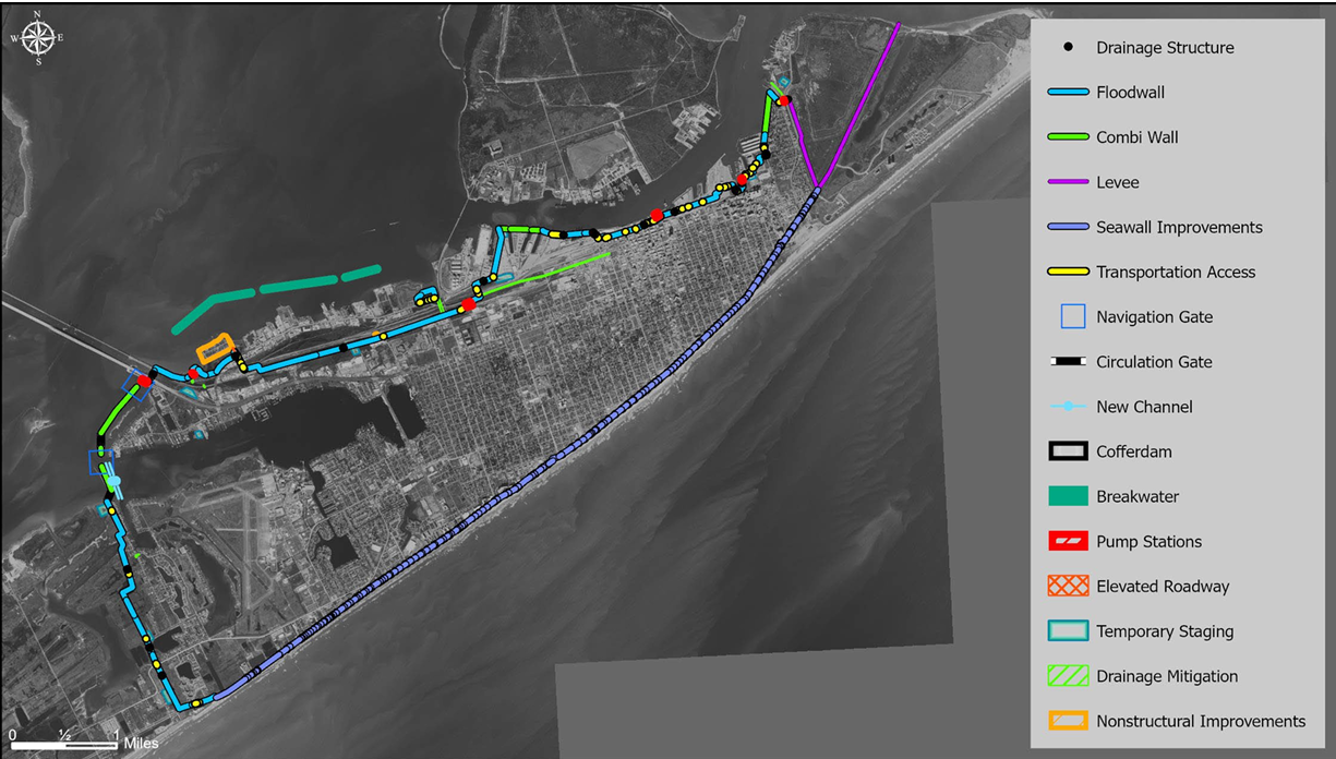
The full Ring Barrier alignment as proposed in the U.S. Army Corps of Engineers' Coastal Texas Protection and Restoration Study.
Section 01
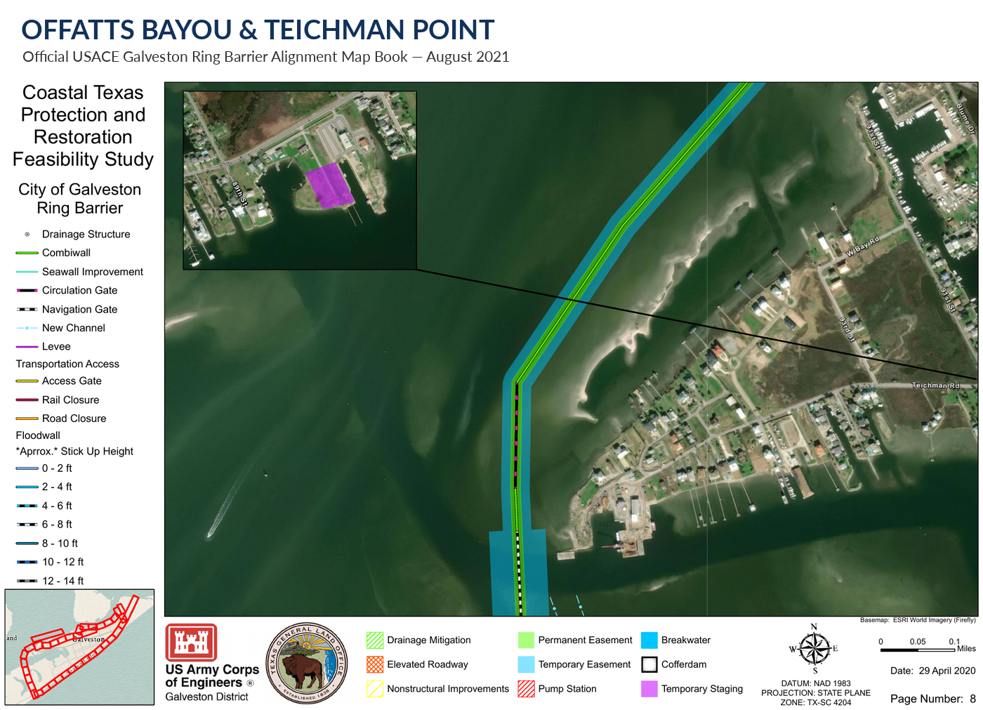
Offatts Bayou and Teichman Point
This is one of the most important connections in the Ring Barrier. The plan must protect Galveston from bay surge while preserving drainage and water access around Offatts Bayou.
The Corps evaluated alternative alignments in this area. The selected concept places the protection alignment offshore of the Teichman Point neighborhood and includes navigation and circulation gates. The Offatts Bayou crossing also requires pumping capacity to move interior stormwater during a storm.
Section 02
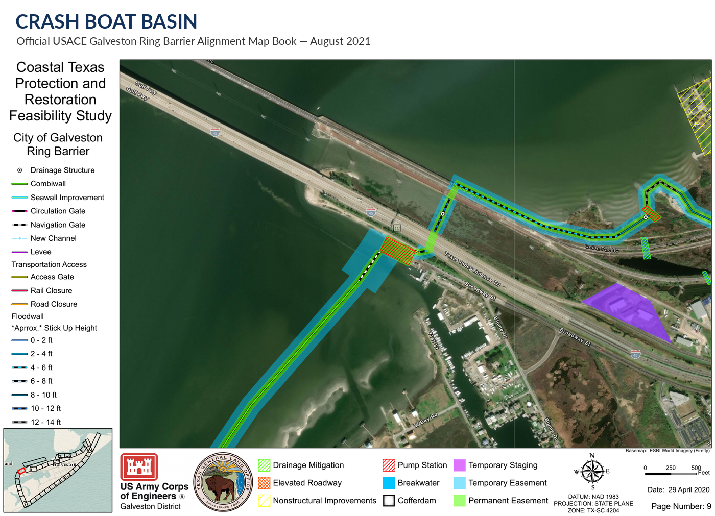
Crash Boat Basin
Crash Boat Basin shows how detailed local conditions can affect the design of a large protection system. The barrier alignment and Offatts Bayou crossing affect existing boat access, water circulation and drainage in this area.
The Corps evaluated these issues and included a new access channel for Crash Boat Basin, along with navigation and circulation gates. The Corps plan also includes dredging associated with the basin and new channel.
Section 03
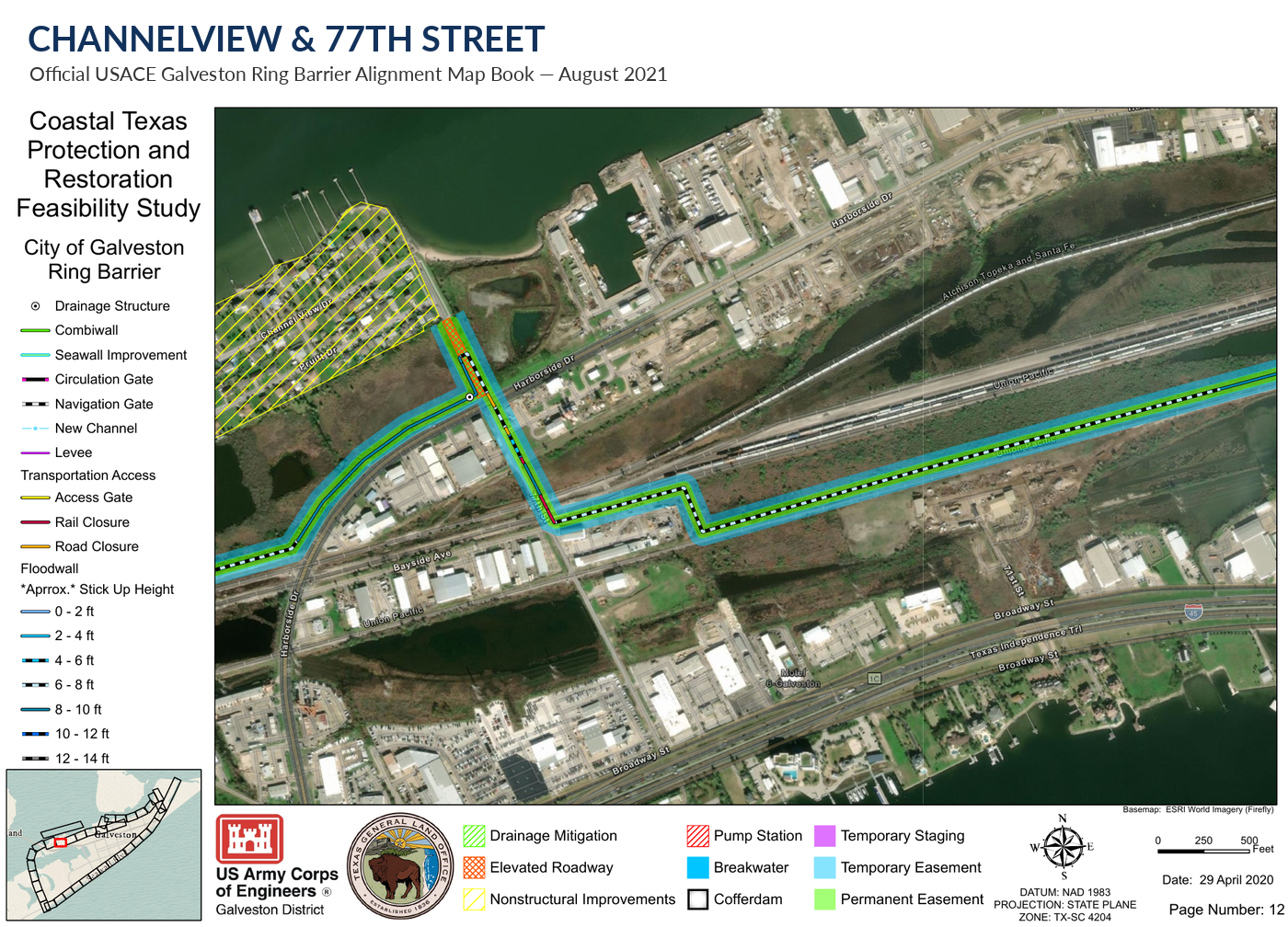
Channelview and 77th Street
In the Channelview area, homes are close to the proposed protection line and are exposed to bayside storm surge and waves.
Rather than relying only on a continuous floodwall, the Corps plan includes additional measures intended to reduce impacts in this area, including offshore breakwaters and nonstructural measures for some properties. Detailed engineering will further refine how the protection system fits the neighborhood.
Section 04
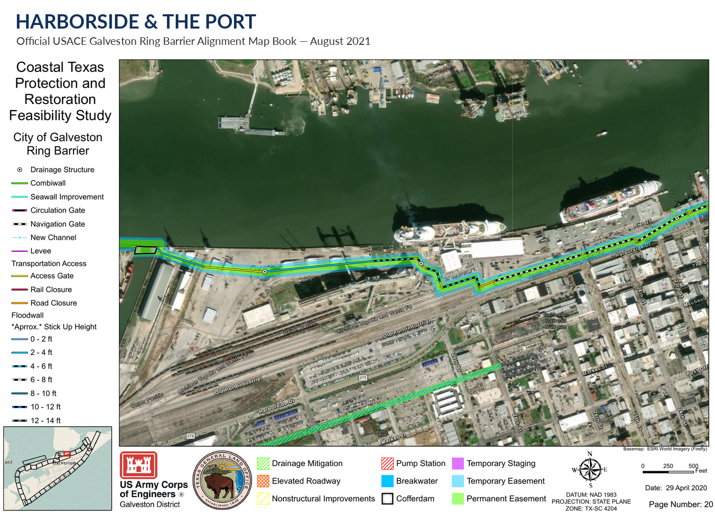
Harborside and the Port
The Port and Harborside area presents a different challenge. Storm protection must work alongside port operations, rail and roadway connections, truck traffic and access to the waterfront.
The Corps plan uses a combination of floodwalls, pumping facilities and closure structures in this developed working-waterfront area. Road and rail openings can remain open during normal conditions and be closed when storm protection is needed.
Section 05
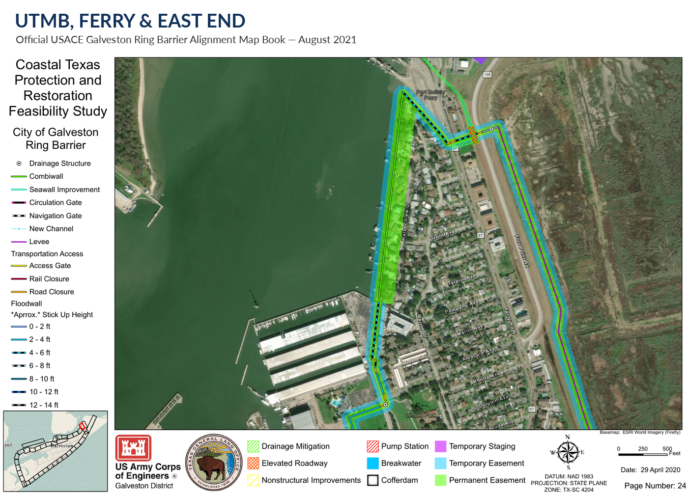
UTMB, the Ferry, and the East End
At the east end of the island, the Ring Barrier must protect UTMB, nearby neighborhoods and other essential facilities while maintaining the transportation connections people use every day.
The Corps concept uses a combination of floodwalls and closure structures rather than a single uninterrupted wall. Road and other openings remain available during normal conditions and can be closed when hurricane surge threatens Galveston.
The Work Is Not Finished
[Placeholder — add your closing text about what remains to be done to fund and build the Ring Barrier.]
[Placeholder — add a call to action encouraging readers to get involved or sign up.]
The proposed Ring Barrier is intended to protect Galveston city proper; the West End, including Jamaica Beach, is outside this barrier.
Source: U.S. Army Corps of Engineers, Coastal Texas Protection and Restoration Study, 2021.